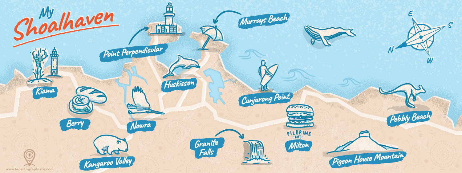

Illustrated map of Shoalhaven, NSW, Australia
Illustrated map of the Shoalhaven area in Australia, selected to be featured in the book "100 illustrated maps of very special places" published by Nate Padavick showcasing 100 maps amongst the 340+ submitted for the contest.
This map was initially my entry to an illustrated map contest curated by They Draw and Travel and Stroly. It shows the Shoalhaven area in New South Wales, Australia, one of the most magical place in the world and one that has changed my life! Nowhere else in the world have I seen so many pristine beaches and native wildlife in such a small area. Can you believe that there are more than 100 beaches in less than 160km (100miles) of coastline?! And how about meeting kangaroos, wombats, cockatoos, dolphins, whales and many more birds and animals on a daily basis?!
- LocationShoalhaven, New South Wales, Australia
- CreditsThis 100% vector map was created by Greg Franco - Le Cartographiste with Adobe Illustrator and without the help of AI. Adobe Illustrator brushes from RetroSupply Co.


