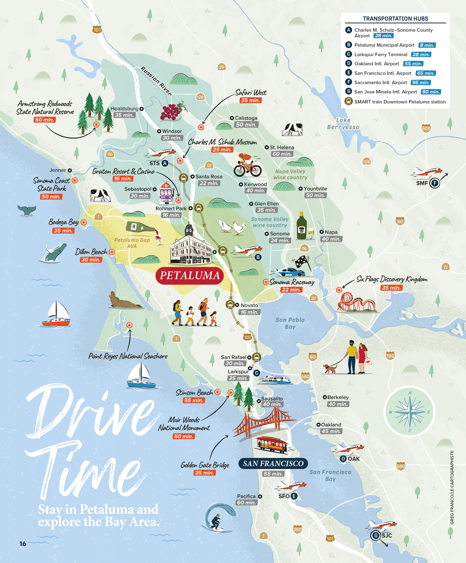

Illustrated map of the Bay Area for Petaluma, CA
Editorial
This illustrated map, used in the Visit Petaluma Visitors Guide, focuses on the Bay Area and Petaluma in California. Its purpose is to show the driving times to the different points of interests and airports in the area.
Therefore, the map is accurate to help visitors orientate themselves while representing in a fun hand-drawn style landmarks, recreation areas and parks, activities, wildlife and more.
- LocationPetaluma, San Francisco, Bay Area, California, USA
- Art DirectorDeanne O'Connor for Wanderlust Content Studio
- ClientVisit Petaluma
- CreditsThis 100% vector map was created by Greg Franco - Le Cartographiste with Adobe Illustrator and without the help of AI. Adobe Illustrator brushes from RetroSupply Co.


