

Illustrated map of Utah for a magazine
Editorial
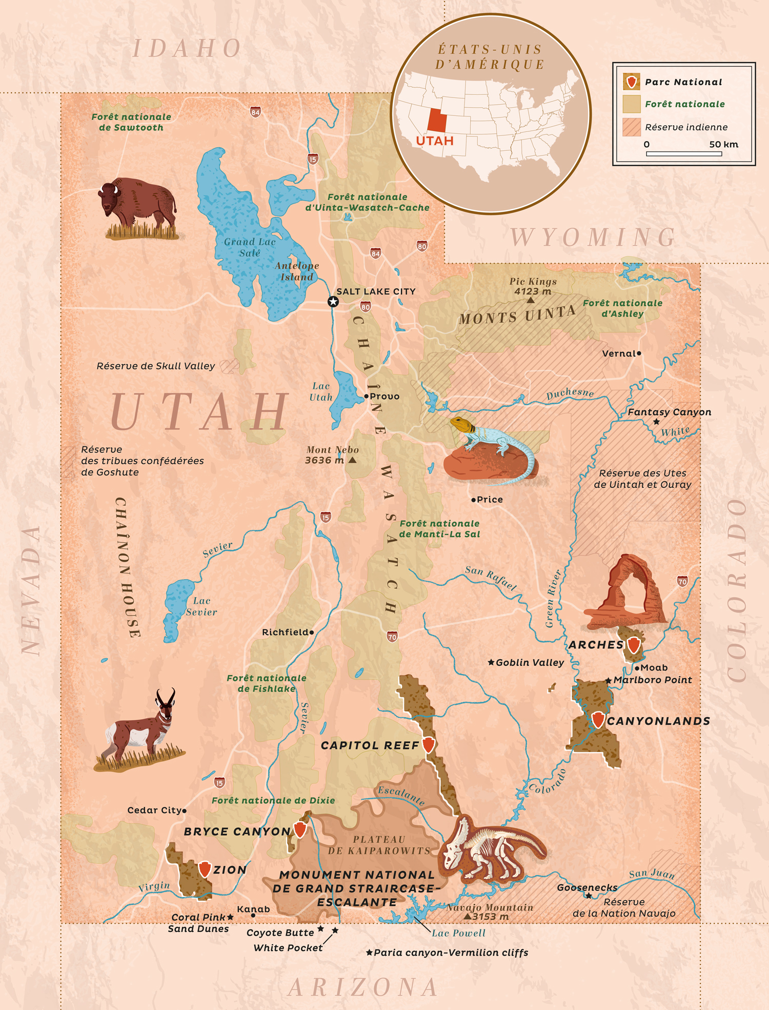
Terre Sauvage, a French magazine dedicated to Nature and wildlife published since 1986, commissioned me to create this illustrated map for a feature on the state of Utah.
The map, a full page, shows the locations mentioned in the feature as well as the state's borders, the location of the different National Parks, the national forests, Indian reservations, the main cities and waterways with illustrated wildlife (bison, pronghorn, common collared lizard) and iconic places (arches National Park, Grand Staircase-Escalante national monument).
- LocationUSA, Utah
- Art DirectorPascal Riner
- ClientTerre Sauvage
- CreditsThese 100% vector map and its various illustrations were created by Greg Franco - Le Cartographiste with Adobe Illustrator and without the help of AI. Map data from OpenStreetMap Topographic data from NASA ESDIS
