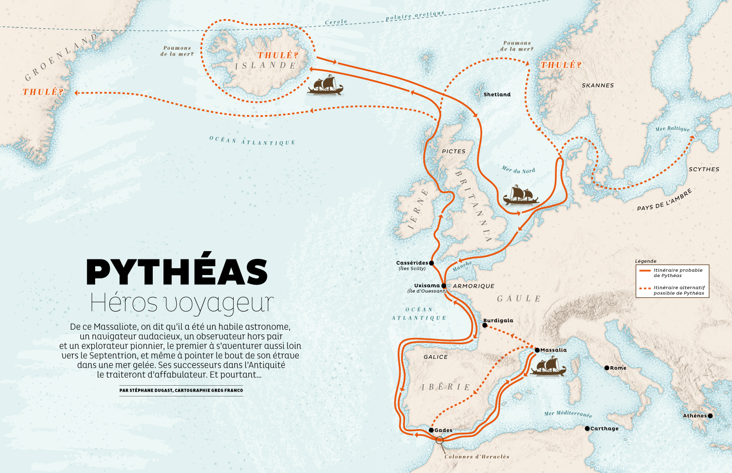

Map of Europe for Terre Sauvage magazine
Terre Sauvage, a French magazine dedicated to Nature and wildlife published since 1986, commissioned me to create this practical map of Europe for a special "Exploration" issue featuring stories about explorers who crossed seas and oceans to discover new lands.
This double-page map is part of a 5 pages story and shows the itinerary that Pytheas (a greek explorer) is believed to have followed around Europe and the Northern Atlantic in 325 BC. He is believed to be one of the first known Greek explorer to see and describe the Arctic, and also the first person on record to describe the midnight sun.
Focused on Europe, the map also shows Iceland and Greenland and features a small trireme illustration, an ancient vessel used by ancient Greeks at this time.
- LocationEurope, Iceland, Atlantic Ocean
- Art DirectorPascal Riner
- ClientTerre Sauvage
- CreditsThis 100% vector map was created by Greg Franco - Le Cartographiste with Adobe Illustrator and without the help of AI. Map data from OpenStreetMap Topographic data from NASA ESDIS


