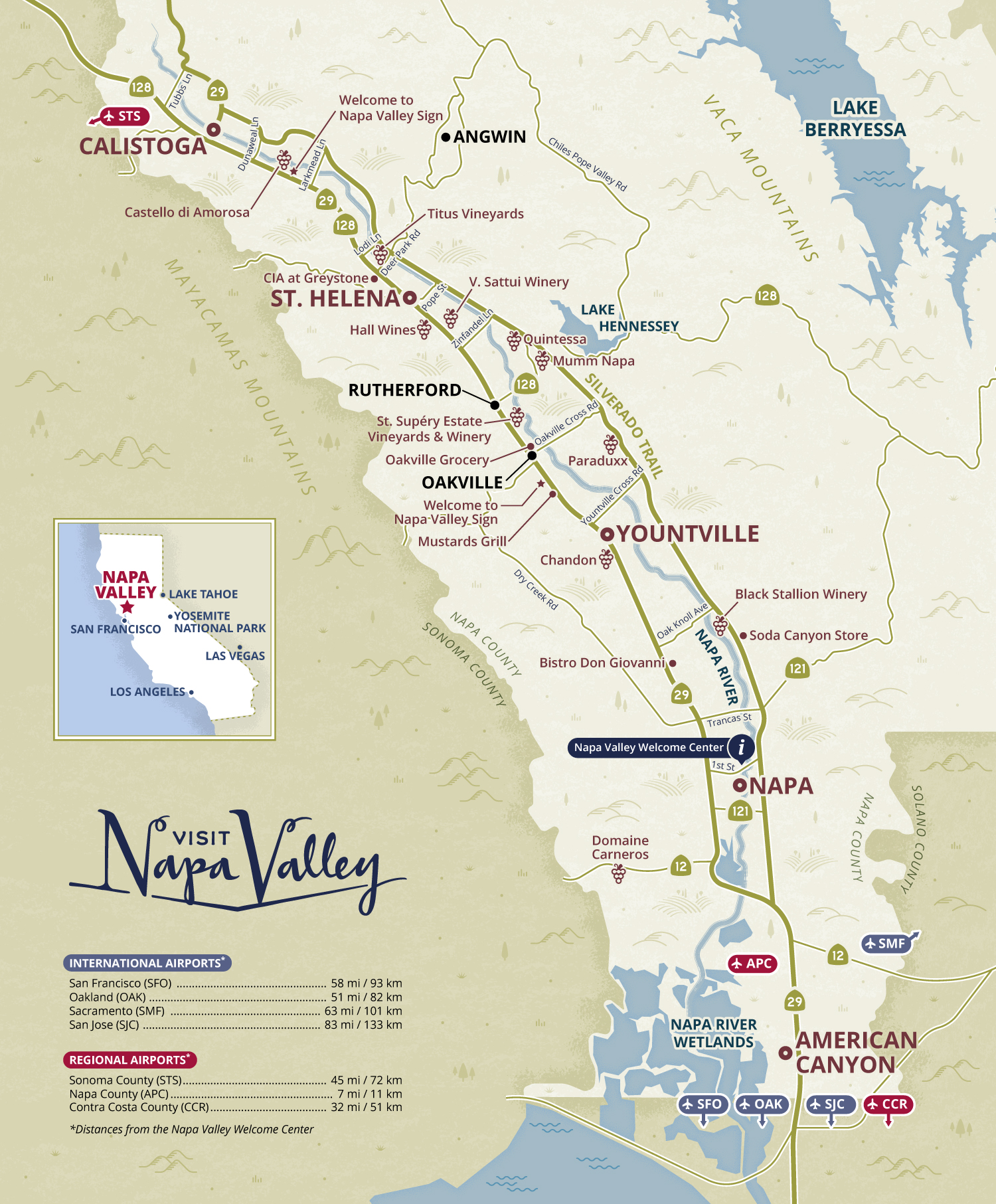

Napa Valley practical map for Visit Napa Valley
Travel
This practical map of the Napa Valley (California) featuring main towns, roads and some points of interest is used in the Visit Napa Valley Visitors Guide and as a stand-alone map handed over to the visitors at the Welcome Center in the city of Napa.
The purpose of this map is to help visitors orientate themselves in the Napa Valley, locate selected wineries and restaurants and discover how far Napa Valley is from the closest major international and regional airports such as San Francisco (SFO), Oakland (OAK), Sacramento (SMF) or San Jose (SJC) international airports.
- LocationNapa Valley, California, USA
- Art DirectorDeanne O'Connor for Wanderlust Content Studio
- ClientVisit Napa Valley
- CreditsThis 100% vector map was created by Greg Franco - Le Cartographiste with Adobe Illustrator and without the help of AI. Map data from OpenStreetMap Adobe Illustrator brushes from RetroSupply Co.


